Total Miles Traveled: 1981.
Times fueled: 7
Avg fuel economy: ~36 mpg
Avg price of gas: $3.85
Times I've cursed various oil-invested groups and persons: yes
Times I've used my National Parks Pass: about 6
Current Altitude (9/15): 3,209 ft.
With my computer problems squared away I can return to the subtle and satirical art of blogging. The past 5 days of travel seems to have flown by as fast as my car down the 75 mile per hour interstates (and 70 mph 2 lane roads) in South Dakota and points west. I wake up at 7 each morning and am on the road by 8:30, but before I know it it's 6pm and I'm looking for a place to sleep.
It's cold at night. No shit right? Normally I would not care, as cold weather camping is not an issue with me. It's the cold weather blogging and journaling that is complicated. Thus, I've only spent 3 of the first 7 nights of this trip in a tent, the rest in a (usually smelly) hotel room. Granted, I'm burning through cash faster than Halliburton, but it's worth it to keep cold at bay and ink flowing. I plan to camp out much more as I approach the southern portion of my trip.
On to the daily adventure recounting and Where's Waldo action:
Day 3, 9/12/08:
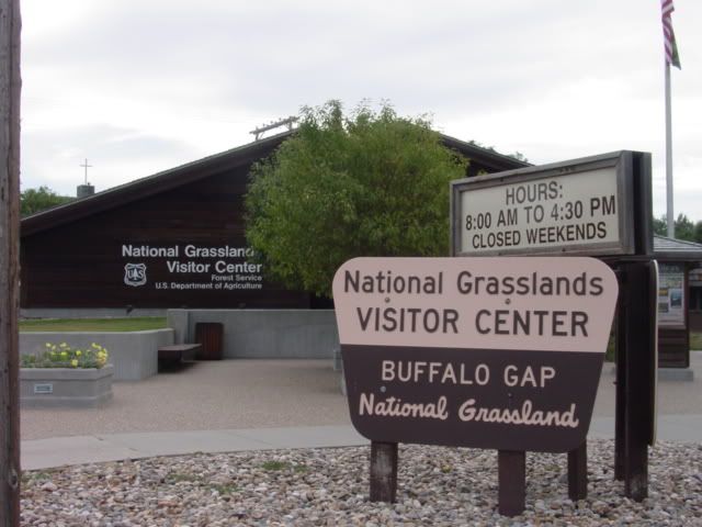
Today's objective was the Badlands and travel into the Black Hills. I started out visiting the National Grasslands Information Center in Wall, about 3 blocks from my campsite of the previous night. Cool video and info. Really makes you appreciate the shear number of federal agencies involved in land stewardship-and whether they could be organized better.
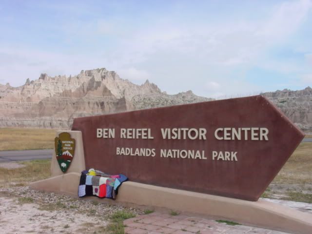
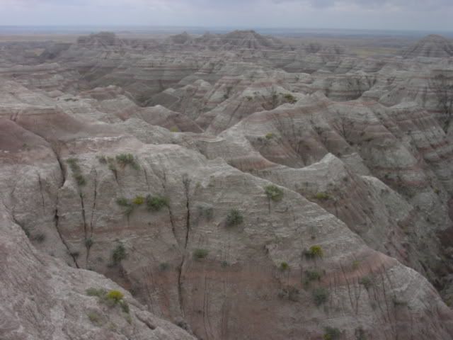
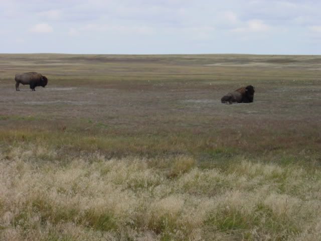
Next I headed to the Badlands National Park. The park encompasses an area that geological uplift in the Black Hills has coupled with erosion and settling elsewhere to expose a large area of sedimentary deposits to the ravages of undercutting by the White River. This has resulted in the unique and beautiful patterns of soft porous rock being stripped away rapidly (on a geological scale), creating this long line of cliffs over just the past 500,000 years. Anways, it looks cool and has a unique place in the park system. It also has prairie dogs and bison. An outrageously expensive shot glass acquired too.
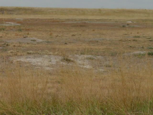
Next I decided to go off the beaten path, driving SW out of the park instead of back up to I-90 on my way to Rapid City, SD, gateway to the Black Hills. It was fun, if dusty, exposing the vast emptiness that is much of the American Plains. It's a nice place to visit and meditate, but live? Not so much.
The Black Hills are another unique geological region resulting from volcanic uplift that thrust the basalt, granite and feldspar hard rocks up from the lower crust layers, exposing them and creating the Black Hills region. The Black Hills are also geologically unique from the Rocky Mountains (and formed by different processes); there relative proximity is coincidence. Anyways, they are cool, forming caves and rock faces for humans to spelunk and carve.
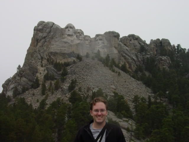
Mt. Rushmore is the most famous attraction in the Black Hills, spawning the rest of the region's growth into a regional vacation destination and Cash Cow for South Dakota. I'm told North Dakota in jealous. The five heads of Mt. Rushmore symbolize all the greatness in America, especially the two with glasses. Shot glass acquired too.
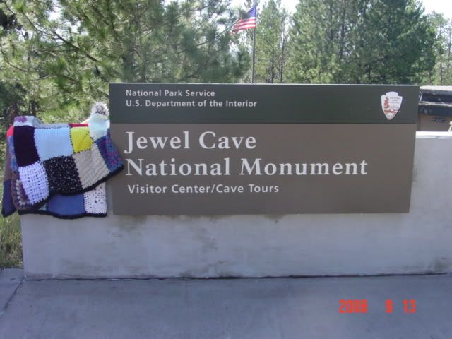
I spent the night in Custer, SD, a town with more hotels than bars and churches put together. It's also close to both Jewel Cave and Crazy Horse, sites on tomorrow's visits.
Day 4, 9/13/08:
Today's agenda includes Jewel Cave, Crazy Horse, Deadwood and Devil's Tower.
In addition to driving rocks upward the events that caused the Black Hills hill and mountai formation created many cave systems that stretch for miles below the region. Jewel Cave and Wind Cave are National Monuments and the largest cave systems in the area, while numerous tourist traps invite you to see other smaller cave systems. Jewel Cave has, I think, 140 miles of mapped area, with an estimated 7 billion cubic foot volume-the 140 miles comprises 2-10% of that volume. Wind Cave is similar but farther south and I didn't want to drive there.
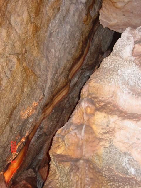
I saw lots of spooky stillness, and was happy that I left my flashlight in my pants from the previous night so I could use it to see into the crevices not illuminated by the trip's floodlights. The most interesting formation to me was the only one that involved cooking, and fortuitously the cooking involved bacon. The formation below is called a bacon ribbon, and is the longest known. I don't recall what the guide said about it otherwise as I was thinking too much about breakfast. $8 to see the caverns, and well worth the 2.5 hour time investment. No shot glasses available, prolly due to the no food/drink/fire theme of the cave.
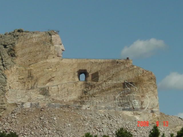
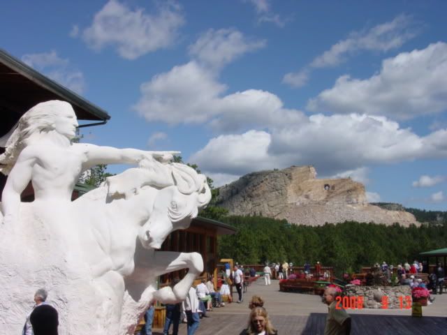
Next is the Crazy Horse Memorial. A bit of a twist on the age-old trait of the White Men building everything bigger and better, Crazy Horse dwarfs Mt. Rushmore. Mt Rushmore is about 90 feet tall (neck to top of head) while Crazy Horse is (or will be, someday, hopefully before I die) 653 feet from horse hooves to the feather in Crazy Horse's hair. It's big. I could see it clearly from 8 miles away. As such it's hard to get a good perpsective on the size given my limited photographic assets, but note that Mt. Rushmore would fit in the area that will become Crazy Horse's hair (right of the finished face). It's that big.
The accompanying museum and tourist trap was less impressive to my eye, as the displays were poorly organized and amateur in their attention to documentation and detail. But there was alot of it, from Kachinas to headdresses. Worth a trip, if only to see how many more thousands of tons of granite have been blown away in subsequent years. Also they do a laser show at night that illuminates the final form- I missed this due to rain the previous night. Shot glass and postcards acquired, along with the beginnings of a farmer's tan.
Deadwood was an overpriced casino. And not even a very cool one. Not worth stopping, even for the (fee-requiring) cowboy and robber kitsch museums. Bought (overpriced) gas and moved on.
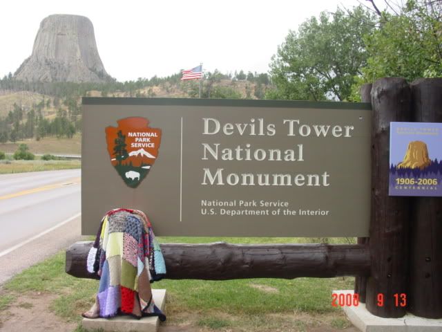
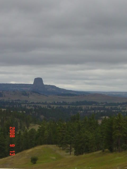
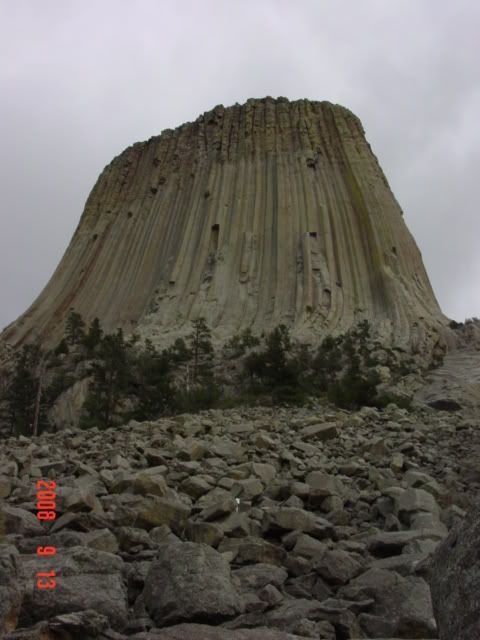
Devil's Tower is amazing. Truly, a natural wonder, landmark and all-around bada-- piece of basalt. The standard theory of it's origin is as a plug of lava that formed at the bottom of a volcano's caldera. Heat and pressure turned it to very hard basalt that resists erosion so well that even though the plug formed a mile below the surface, the rest of the land has eroded down to the level of the plug and then 700 feet farther down. The unique hexagonal pattern comes from the way it cooled and cracked, similar I'm told to how cracked surfaces form on a mud puddle. /shrug ok.
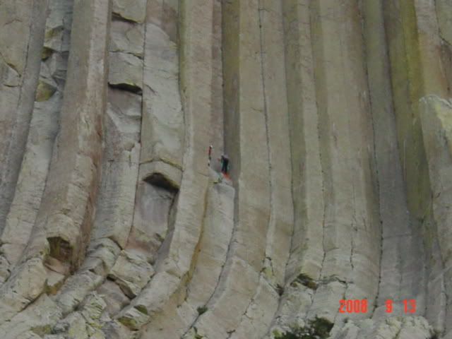
Crazy People were climbing it, and a climber dude told me it takes 3 hours for a skilled Crazy Person to ascend and an hour to rappel back down. Notice their size relative to the rock face in the pic below. Well worth the stop.
Wyoming is big. Or as a guy told me at the next gas station, "F---ing huge". So I decided to get a head start on the slog to Grand Teton that day. I drove until 7pm all the way to Buffalo, WY from Devil's Tower (which itself is NW of the Black Hills 30 miles, and on the foothills of the Rockies, sorta near Sundance, WY).
My fingers hurt, I'll update for days 5,6,7,8 tomorrow. Plus this is already getting to be a long post. If you have any questions or comments feel free to ask in the comments section below; I'll provide whatever answer I can in a customarily snarky and hopefully funny way. Also, feel free to email me Q's if you don't want to create an account, needed to leave a comment. Although blogspot is run by Google, so you can use that password and login to create a Gmail account as well. Fhorvath@gmail.com
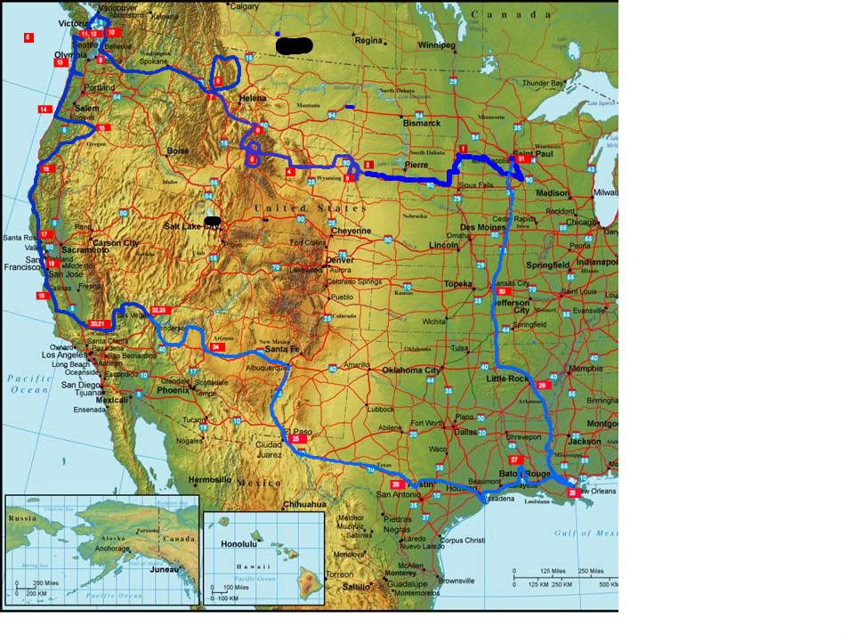
Also, I updated the travel map, and am adding a link to the image dump region I'm putting all my pics on and hotlinking from. Feel free to visit for some other more in depth images-often they have descriptions.
Adieu!
No comments:
Post a Comment