Tuesday, November 11, 2008

Home and a final post


Hello

So I've decided to not make a regular post about the trip from New Orleans to Minneapolis. Really, it wasn't that interesting and was mostly a bunch of driving. I did however stop in Little Rock, AR overnight and visited the Clinton Library, pictures can be found in the Photobucket.

Above are the unwrapped shot glasses and assorted knicknacks I collected along the trip. All told I have 27 souvenirs:
Death Valley, California.
Columbia River Maritime Museum
Stone Dinosaur, Wyoming Dinosaur Museum, Thermopolis, Wyoming.
Pacific Coast Rock, found along the beach in Washington State.
Tillamook Cheese Company, Tillamook, Oregon.
Mount Rushmore NM, Black Hills South Dakota.
Obsidian shard (for the) Big Obsidian Flow, Newberry National Volcanic Monument, Oregon.
William J. Clinton Presidential Library. Little Rock, Arkansas.
Spam Museum, Austin, Minnesota.
Seattle, WA.
Grand Teton NP, Wyoming.
Badlands NP, South Dakota.
Mount St. Helens Historic Site, Washington.
Sea Lions Cave, Oregon Coast.
Eruption flipbook, Mount Saint Helens, Washington.
Crater Lake NP, Oregon.
Monterey Bay Aquarium, Monterey, California.
Victoria, British Columbia, Canada.
Crazy Horse Memorial, Black Hills, South Dakota.
Bourbon St, New Orleans, Louisiana.
August Schell Brewery, New Ulm, MN.
Petrified Wood (for the) Petrified Forest NP, Arizona.
Carved California Redwood shotglass, Redwoods NP, California.
Corn Palace, Mitchell, South Dakota.
Grand Canyon NP, Arizona.
Glacier NP, Montana.
Wall Drug, Wall, South Dakota
Olive wood vase, from Crater Lake NP store.

Now for some numbers (9/10-10/10/08):

Total Miles Driven : 8899 miles.
Gallons of Gasoline: 253.43 gallons.
Total fuel cost: $903.43
Miles Per Gallon: 35.11 mpg
Average price per gallon: $3.56

Nights stayed in a tent: 6
Nights stayed in a hotel: 24

Trips to McDonalds (breakfast specifically): 16 (12)

Times I used my National Parks Pass: 15
Amount of park fees (approx) $280
Cost of a parks pass: $80

Total Trip Cost (including new laptop PC): $4302 (give or take).

I would like to thank everyone who has read and commented on my blog. This concludes the Blanketing the West blog. Thanks!

Saturday, November 1, 2008

New Orleans and the South.

New Orleans

Day 28:

I left Kinder in the morning after making a one night reservation at the Ambassador Hotel in downtown New Orleans. After driving across miles and miles of elevated highway that crossed vast expanses of marshland I passed Baton Rouge and headed south to New Orleans. I arrived and had my first experience with valets on the trip. The room itself was only $50 for the night and included a breakfast and free parking; I understand that these prices would have been unheard of before Katrina. Anyways, after parting with my keys I wheeled my cart of Tupperware up to the room.

I must say, even for a converted warehouse the Ambassador is a nice place; probably the nicest place I stayed all trip.


The room had the original hardwood floors, roughly refinished. It also has a window with a great view of the brick wall 2 feet away, but still, it was a nice place, and for so little cash in downtown New Orleans. I relaxed for a while, watching the news and blogging, before venturing out into the humidity of the New Orleans evening.

Bourbon Street is northwest of the Ambassador Hotel's location on Tchoupitoulas St (choopitoolas), centered here, about 1 mile. Bourbon street is the main drag in the district, but there are many clubs, restaurants and tourist traps in the French Quarter surrounding Bourbon Street. The street itself was barricaded off from vehicles by the time I got there, and I suspect that they would make it a pedestrian walk for about 8 blocks but for some unknown reason.

I didn't take my camera, as, suspecting a situation similar to that of Amsterdam, that it would be more trouble than it's worth ('accidentally' or not, taking a pic of a prostitute's stall in Amsterdam will get your camera smashed, at least went the legend).

Now, this is pretty cool: I found a place to eat at a restaraunt called the Chartes Inn (or something, Place maybe?). While looking for the restaraunt's names and such I came across the Google Street View software system, and found this shot. Assuming it loads correctly this is a street view of the place I ate, and I can tell I ate there because the wall colors and door were very distinct. Technology is wonderful. Anyways, feel free to mess around with the street view thing for awhile, and get a feel for the atmosphere and such of New Orleans. Dinner consisted of an appetizer of a baked crawdad cakes, and an entree of a true tourist feast: the New Orleans Sampler consisting of bowls of jambalaya, red beans and gumbo. mmmmm. It was amazing. And it cost $40 (with white wine). But it was worth it. Best Food in America, in my new opinion. After I was fat and happy I backtracked to a cigar shop I had passed earlier and picked up a nice Macanudo which accompanied me as I sauntered toward Bourbon Street proper.

"Bourbon Street" is about 8 blocks long. The southwest end meets Canal Street and is mostly strip clubs while the northeast end is mostly jazz and music clubs. Again, using the Google Mapview thing I found the Jazz Club I visited: the Maison Bourbon, dedicated to the preservation of Jazz. Now, I don't pretend to have a deep appreciation of jazz. It is a form of music that doesn't really speak to me, but my friend and Jazz musician Mike Cain has educated me enough in the art of jazz to know good jazz when I hear it. And this club had good jazz. After the purchase of an $8 Guiness I listened to two sets by Louis Ford and his New Orleans Flairs. Again, jazz doesn't speak to me as it does some, but I could appreciate the extemporaneous nature of their music, and ended up (after a second Guiness) purchasing a CD of the group's works. I listened to it on the way home and I like it, but alas, I fear jazz will never be my thing. But I know that patronizing the things you appreciate is important, and I hope that my drinks and CD will help keep jazz alive in it's birthplace.

With a couple pints and a white wine in me I proceeded down Bourbon street south, past the skin and celebrations. Many tempting offers were directed my way by the eye candy, but an empty wallet and my better angels prevailed. If you're interested in the sites the Google View thing shows the entire street (strip?) and you can view to your heart's desire.

I made my way back to the hotel to sleep off the fun. Of the places I've visited this trip Bourbon Street's culture and proclivities were one of the most memorable, putting for example Vegas to shame and I am trying to figure out ways of getting back there again. Of all the places in America I suspect this one reminds me the most of 'Europe' and of course Amsterdam in particular. The combination of colorful people, places and relatively subdued commercial nature of New Orleans has retained it's appeal thru hurricane and strife, and I for one hope it never dies.

The trip north later.

Tuesday, October 21, 2008

Texas

So remember when I was amazed at theinterstate sign in California that listed exit 830 or something, and thought that was big. Well I drove the entire length of I-10 from El Paso to Orange, and exited the state at mile 825 or so.

Day 26, 10-5-08:
Leaving my room in El Paso I surveyed the map and locked my destination into the GPS. It happily told me to drive for 8 hours or so. I sighed. Texas is a big state, and contrary to some memes is not actually flat. It's just mostly flat. And dry, and a bit like cornfields, only replace 'uggh corn' with 'uggh sagebrush'.

It is also a very fast state. I enjoy moving quickly between destinations, and typically consider 75 mph to be the top of my comfortable driving speed. My car's transmission gearing was not meant to go much more than 70, so my tachometer starts creeping above 3000 rpm when I hit 72ish. The speed limit on I-10 from El Paso to Kerrville is 80. 80 freaking miles an hour. Thankfully there isn't much traffic along the route on a weekday, but man, it gets disconcerting when fully loaded semis travel around you at those speeds; the inertia they carry is downright nauseating to think about and what it would do to you. So, I gritted my teeth and barreled down the road at Ludicrous Speed.

---

Before moving to Minnesota with the parents when I was 12 we lived in Williamston, MI. Our neighbors there were the Bonds, and I was friends with their daughter of my age, Amie, when we were small. Like, 3-4 small. They movved away then and ended up in the suburbs of Houston, before moving to Kerrville a few years ago. I contacted the Bonds and they agreed to put me up for the night. I arrived around 6pm at their 80 acre ranch, and was greeted by Mr. Bond at the front gate.

I dont really remember the Bonds. I've met them after they moved away but in reality I didn't know what to expect. I was pleasantly surprised, and kept having these half-remembered memories pop into my head as we were talking that great. First Mr. Bond let me ride a four wheeler as we rammed around the ranch to feed the deer. See, Texas gives a tax credit for properties that are used as farms or ranches (both) and the Bonds have a deer herd. In addition to domestic white tailed deer they have populations of Indian deer and something else, and the only species name I can remember (forgot to write them down) is the Black Buck, from India. They sell the animals to game farms that operate throughout this part of Texas, as well as hosting their own shoots.

We went to a nice Mexican restauraunt for dinner, Mark, Linda and their youngest daughter Adrianne. Aftre returning to their ranch I discovered with delight that Mr. Bond had a beer keg on tap, and we spent the the next few hours talking about life, family and good things.

Day 27, 10-6-08:
I awoke the next morning, late, to note that Mr. Bond had already left for a long trip around the country for his busines, and Adrianne was at school. Mrs. Bond and I talked for a awhile, and having made contact with Amie who lived in Austin now, I bid her farewell. It was a great time on their ranch and I really appreciated the Bond's hospitality and memories.

I drove from Kerrville to Austin, and along the way stumbled on the Lyndon Johnson State Park and museum(s).


I drove through the town of Johnson City, which evidently was founded by LBJ's family. I arrived at Amie's apartment complex, and after soem awkward moments owing to the fact that for most intents and purposes, we were strangers, we set off for lunch at a place nearby.

We had a pleasant conversation, where I learned that she had only recently returned to Texas after living in New York City for the past 7 years, working recently in music licnesing for NBC. She nows does her job from Austin, where she got to keep her NYC-size salary. I admit, I am a bit envious, and we parted amicably, and she gave me some cool places to see in downtown Austin. I stopped there for an hour, visiting the famous Bat Bridge and some of the music scene of Austin, which during the day is unsurprisingly pretty dead.

Next I drove Southeast to Houston. Not wanting to stop in Houston proper I decided to drive out to Galveston to look at the aftermath of Hurricane Ike. Originally this sounded like a good idea, but it quickly became obvious that it was a bad and not very honorable one, what with gawking at people's misfortune. I then decided that my intended trips around the lower ninth ward and similar areas in New Orleans were a similar no-go.

I tried to find a place to stay along the gulf coast, anywhere along the gulf coast, but was continually out of luck. Every hotel from Galveston to well into Louisiana was booked solid with repair teams cleaning up after the season's hurricane damage. I finally found a room in Kinder, LA, after searching until 10 at night, and 25 miles north of the I-10 corridor. But even that place was $80 for a Days Inn.

And with that, I'll leave New Orleans until tomorrow. Bye!

Sunday, October 19, 2008

The Grand Canyon and Petrified Forest National Parks

The desert is big, it's hot and it has cool stuff in it.

Day 24, 10-3-08.

I left Las Vegas early, or at least tried to, as I needed to carry 3 loads of stuff back across the casino floor to my car. I considered sticking around for another breakfast, but decided to get a move on instead, as I didn't have a good conception of time to and from the Grand Canyon.

First notable thing along the way was of course Hoover Dam. Not wanting to spend the time or get hit by all the cars like my own I didn't stop fro the dam tour. Or at least not of my own volition, owing to the security present. I suspect that someone post-9/11 wised up to the idea that it would be pretty easy to disrupt alot of people's lives if they did something to the dam while traversing it along route 93 from Vegas to Kingman, AZ so they put in checkpoints. They are also building a big huge bridge that will span the canyon downstream of the dam proper. While I'm sure the idea of additional lanes along the road was proposed to reduce congestion (the dam is 2 lanes wide) I bet, and hope it's also due to security concerns. The Google Earth pic of the area shows the construction project;the spans are almost linked in the middle as of my trip through them.

Anyways, the desert is big, and yet, it's not really that boring (or at least not cornfield boring). There are lots of vistas, colorful buttes and relief that kept my eye interested throughout the drive through Kingman and onto I-40, then the turn north towards the south Canyon road and the Grand Canyon Village visitor center. I had thought about going to the Indian overlook thing, but it was kinda pricey, and I have national parks pass, after all.


This overhead view of the Grand Canyon region by Grand Canyon Village looks visually impressive by itself, but gives no real information as to the scale of the thing. There is a big huge drop off.


Again, my pictures do not really do justice to the scope of the canyon. I was, really, impressed. It exceeded my expectations, but alot, and I am glad that I decided to go.


One of the nice things about crowded parks is that there are often people around to take your picture.

After picking up my jaw I returned to the visitor's center and bought souvenirs, and while again looking for postcard stamps (I never did find any, along the whole trip) I saw four bluebirds carrying on in a tree near the center.


The two males were palling around while the females flitted about another tree. Reminded me of a middle school dance.

I departed the canyon area around 6 at night, and the sun by this time of year is setting ever earlier, making my trip harder to make; if it's not light out I need to spend more days to see things instead of 2 or 3 things on one day. I drove south towards Flagstaff through a Navajo reservation, where all the day-traders had already packed up there wares for the day.

I approached Flagstaff around 7:30, and decided to continue on awhile to get closer to tomorrow's destination: Petrified Forest NP.

I ended up in Winslow, Nevada, and the Worst Hotel Of the Trip. Granted, what do you expect for $30 a night? Well, not much, but what I think I can expect is the absence of cockroaches.

Ah yes, cockroaches. Perhaps living in the north has coddled me, but this was the first time I had seen a live, wild cockroach. The first one crawled up the wall behind my television. The second crawled across the end of my bed. Then I called the manager. I got a new room, but suffice to say my night's sleep was fitful, and spent inside my sleeping bag on top of the bed.

Day 25, 10-4-08:

I left my creep-infested hotel room and traveled a few miles down I-40 to Holbrook, Nevada and took state route 180 to the southern end of The Petrified Forest National Park. Note that alot of the route here near I-40 is the historic route 66, and there was much fanfare and tourist-trap related to this fact. I stopped at a rock shop along the way and picked up a souvenir chunk of pertrified wood (a tree branch sized-piece it looks like) as I read you cannot pick up the petrified rocks. Which is all good.


In many cases, from a distance you would not be able to tell that the tree pieces were fossils or just downed timber. But up close the difference is clear, and the detail is often striking. Rings, injuries, insect damage, bark impressions are all starkly visible on the surfaces of the trees.


60 million years old? Some could have fallen last week.

Petrified Forest is more than a preserve for the trees though, and encompasses many scenic overlooks and natural formations like the Blue Mesa.


Then I found a welcome dose of humor: A tumbleweed!


This one as parked in an overlook, and rattled and rolled when kicked, punted and thrown. My first tumbleweed of the trip and an amusing one at that!

The Bonds, a family I knew from Williamston live in Kerrville, TX and invited me to stay with them tomorrow night. But first I had to get there. The park has a convenient onramp for I-40, so I began the long drive east to Albuquerque. At Albuquerque my gps told me to take a shortcut along AZ 6 to get onto I-25 south to El Paso.

So, I drove some more. Then, I kept driving. Did I mention the driving?

I arrived in El Paso around 8 at night, and as the Cockroach Inn didn't have wireless, I had to wing a place for the night. That was a chore, as El Paso seems to be laid out very strangely. I finally found a Motel 6 and rewarded their clever prominent price display with my business for the night. I settled in and prepared for another long drive tomorrow to Kerrville, far away in central TX.

Friday, October 17, 2008

Las Vegas and the desert southwest.

I've had a cold. It hasn't been fun. But now I'm felling better, finally, so here's an update!

Day 23 and 24, 10-2/3-08: Las Vegas Nevada.

So, Las Vegas. City of Sin, Gangsters and hit CBS TV shows.

Honestly, I wasn't all that impressed. I made a hotel reservation online at the Vegas Club Casino Hotel, which is on Fremont street. I finally arrived around 6 in the afternoon and right off the bat, things were going poorly. My clutch made an ominous and sharp squeak whenever I pressed it, and my car smelled like brake pads, all a legacy of Death Valley. Anyways, after driving in circles trying to find the specific hotel and more importantly its parking deck I managed to go the wrong way on a one way street just long enough to duck into the parking area.

I made my way to the Club Casino check in area to learn that in fact my reservation is not at the Club Casino, but at the Plaza Hotel and Casino, which (of course in Vegas) is owned by the same company. So I lug my armful of bags to the check-in at the Plaza, across the street, and find my room. It was spartan but inexpensive and served my needs. Mostly. I went back to my car still at the Vegas Club parking deck and move it to the Plaza deck. But, I'm in the north tower, which, as opposed to the south tower does not have it's own parking deck. Did I mention it was Biker Week?

Note that on this trip I packed for camping more than hoteling and all my stuff is in Rubbermaid totes, as opposed to suitcases. This is logical for camping, as well as stuffing are car full with, but not for walking through the casino floor from south to north tower. Three times. Yes, I could have used a valet, but they are expensive, and really, that would ruin the rugged individualist thing I'm working on.

I finally get to my room and decide to watch TV. Alas, there are 3 channels. Noting that in Vegas they want you to leave your room, I understood this clever ploy and pulled out my laptop to blog thereby defeating the evil capitalists. Lo and behold, the $20 fee for internet for my stay presented itself, and I began to understand why Vegas is said to run on money and little else. I blog, I eat and I relax under the din of the loud and not very effective AC for a few hours, before braving the desert heat for a walk around Fremont Street.

Fremont street is old Las Vegas. Where the original casinos stood. Thus, it is more run down that other parts of the city, and they needed a shtick to make people to want to continue gambling there, as opposed to the shiny new places down the strip a few miles. So, they built the Fremont Street Experience. Basically an awning that covers the street, it provides protection from the desert and entertainment through it's ability to light up and 'play' shows. Also the street vendors, musical acts and other kitsch set the mood; I was reminded heavily of the Red Light District of Amsterdam, especially when passing the solitary gentlemen's club defiantly displaying its flesh for the masses.

I ambled about taking in the sites and sounds, and deciding whether any of this was a good idea. It really made me feel lonely, in this crowd of people, unlike anything I had ever experienced before. At least in other big American and European cities the people were there to do touristy stuff or otherwise live. Here it was full of retired folks in their go-cart like scooters, zipping around from one buffet to the other. The multitude of gamblers, casino employees and miscellaneous inhabitants all seemed to be waiting for the other shoe to drop. Eerie, and depressing. I've been to casinos in Minnesota and Atlantic city, and they never had the sort of garish 'waiting for the endtimes' vibe I got from Fremont street. Maybe it's different at the nice places down the strip, but here, I really wasn't that comfortable.

Then there's the alcohol, and the casinos themselves. You can buy and consume beverages anywhere on the street, it's like an open beer garden with motorcycle daredevils racing around in their ball standing in for the background music. And people often gambled while blitzed, and while I can understand the benefits of this from the casino's standpoint I really marveled at how people so blindly let themselves be fleeced. And none of the casinos had doors; just wide open expanses where people could amble in and out at will. Admittedly, the psychological impact of this much glitz and guilt was impressive, and I came to understand, on some level, what people find so appealing about Vegas.

And then I found my vice, or maybe more appropriately, the level of vice I could afford: $3 blackjack! I played for 3 hours, losing about $20 an hour, which is a respectable rate.

By now it was 11pm, and not wanting to test the 24-hour nature of the place too much I retired to my room. I discovered that the mattress is lumpy.

Day 24:

I awoke nice and late, ready to do some sight seeing. I found one of the famous buffets, and ate the cafeteria quality bacon, eggs and fixings til I was set for most of the day.

I then discovered that, really, there isn't all that much to see in Vegas that I cared to experience. So I walked down the strip to the famous water fountain (a la Ocean's 11). This took most of the day and I concluded that it wasn't a very good idea to walk about Las Vegas.

I arrived back at my lumpy mattress containing room and took a nap and blogged some more. Then I planned tomorrow's trip past the Grand Canyon, went and found some more $3 blackjack tables, and proceeded to gamble away another $60. Next I watched a Queen montage and tribute on the Fremont street awning, noting the irony of all the bikers miling about googling at the Queen Experience. I bought myself a nice, big, ~30oz beer in a container shaped as a football (after the gambling was done :) ). Then I headed for bed.

All in all, I don't really like Las Vegas. Or maybe, what I should say is that I don't like Vegas on a shoe-string budget. "Duh" may be the appropriate sentiment when you consider the context and purpose of Las Vegas, but still, I didn't go away from the city feeling like I had added anything to my trip.

And no, I didn't take any pictures in Vegas. I didn't want the hassle when moving through casinos (and their potential security). Sorry!

Grand Canyon and environs next!

Sunday, October 12, 2008

California part 3, and Las Vegas

Greetings!

I arrived back in Minnesota on Friday the 10th, so all these posts are now finishing my recollections of the trip. I realize that I often switch between tenses erratically in many of these posts. All I can tell you is that I switch tenses whenever my recollection changes, and it's my blog, so you'll just have to deal with it! /shrug

Days 20 and 21, 9-29/30-08:

I was invited to stay with my Aunt and Uncle, Carolyn and Dave Gilliam. They live in Tehachapi, California, which is about 30 miles East of Bakersfield.

Leaving my hotel in Soledad, CA around 10am (lots of politics to read) I set out across central California for Bakersfield and Tehachapi. There appears to be alot of agriculture taking place in this part of CA, which I'm sure will come as a surprise to everyone. But seriously, the part that did surprise me was the lack of water in any location not being actively cultivated. I didn't realize it until I drove through it, but the California fruits, vegetables and grains industry is almost entirely dependent on irrigation. Check out this link that illustrates the point if the land is not irrigated it is brown and a desert, but upon irrigation it turns bright green on the satellite maps. I was under the impression that the area was always marginal for agriculture, but had no idea it was that marginal. No wonder California is so big on water projects and politics.

Anyways, I arrive at the Gilliam's around 5pm. I had never met the Gilliam's before, as they had always lived in California. They are my relatives on mom's side, and have roots in Flint with her. I don't know much about Mom's family, but Aunt Gilliam showed me a suitcase full of pictures and portraits, including many of mom before she was mom. Surreal and enlightening are the adjectives that come to mind.

They live on a 4 acre ranch in the Bear Valley community of Tehachapi. It is a planned community with many different housing plans to suit the needs of horses, golfers, snow birds and everyone in between. They ride their two horses on the trails throughout the area, accompanied by their hyperactive and lovable dog Cleo. A tribe of cats rounds out the family.

I spent a day and a half there, biding my time between sleeping, a trip into town with Aunt Carolyn for supplies, and generally not driving. Thinking it a bit impolite to take pictures of someone's house, I have few images from this period, but here are a few of us as I left on the morning of the 30th.


Did I mention it's really bright in the desert? I'd like to thank the Gilliam's for their immense hospitality, steak, pork chops, apples, oil changes, and graduation gifts. You helped fulfill one of my trip's goals and speeded me along my route with love and consideration. Thanks!

Day 22, 10-1-08: Death Valley and Las Vegas

I departed around 8:30 from the Gilliam's ranch, making my way northeast along highway 14 -> 395 -> Death Valley NP. I planned a long driving day for getting through Death Valley on my way to Vegas, that in retrospect my squeaking brakes, squeaking clutch pedal, brake and clutch smells were agonizing over.


Death Valley is impressive, certainly, in terms of the stark differences between the flora and fauna of the Valley from the surrounding plateaus and mountains. What I wasn't prepared for were the amazing elevation changes that allowed those differences to occur. I know, right: "No sh-- Frank, Death Valley is below sea level out in the freaking Rockies!" but it's more complicated than that.

Death Valley was formed by the subduction of tectonic plates in coordination with the same forces that cause the San Andreas fault. I wondered whether these forces also formed the Grand Tetons like I alluded to in the Tetons post, along with the hot springs, etc in Yellowstone. Anyways, the whole valley didn't just erode away to its present below-sea-level form (even if that were possible) but rather the valley sank as plates were upended, and Death Valley fell between the plates as they buckled. If the area had more water the whole floor would fill to a many hundred of food deep lake. Yet the lake has no outlet, so it would be as salty and hostile to life as it is in its present drypan form.


What all this geology and whining about brakes and clutches means in practice is that:
1. Death Valley travel requires about 20,000 feet in total elevation change; there are 2 ridges that you need to cross into and out of the park.
2. The main descent from the east is 6000 feet in about 10 miles. 1/10 of a mile down per mile traveled. That's steep.
3. A--holes and f--ktards love tailgaiting into, around, about and everywhere imaginable involving Death Valley. And gods forbid the 32 foot long motorhomes should use the turnoffs. ever.

/fume

Anyways, after riding my brakes and clutch in unison with white-knuckled grip on my slippery driving wheel (to reduce overheating the AC is considered taboo for this drive. Personally I think the park rangers are just sadists for imposing this rule). I come to a wide spot in the road with the peculiar sign below.


The crazy thing is that it doesn't feel like you're at sea level. You're out in the middle of the desert Rockies, which your mind tells you are 3000 feet and above, right?

No? got me But I do trust my eyes for other things, and more than the sign, what really got me was this artifact and what happened to it during the drive:


What, a coke bottle? Yes, a but more importantly, what happened to it. Being from a low-lying part of the country for my life that only experiences with real elevation I've had prior to this trip was Philmont, a Boy Scout Ranch in New Mexico. But I didn't pay attention to this kind of stuff, so for all intents and purposes this was my first 'eyes open' exam of altitude.

I sealed this pop bottle at the top of the pass, 6000 feet.

And it imploded. All on its own. My nalgene bottles did the same thing, even as they are much thicker plastic. This was, well, astonishing to me. Perhaps that shows my naivete, but hey, it was cool to me. And it was as true a demonstration that I could think of of what Death Valley is. A Big Giant Hot Hole.

A pretty hole, to be sure, but hot. HOT. I could taste the dryness, the saltiness, the oppressive 'blech' of it all. And I realized how they could possibly make a contiguous 4000 or more square mile park without disturbing the people who live there:

No one in their right mind would want to live there.


I drove up the other side of the park and into Nevada. I wanted to drive past Groom Lake, Trinity and the other Department of Defense sites on my way to Vegas, so I took highway 95 from Death Valley. Alas, I was not abducted by aliens on the trip.

Or so I think?

Las Vegas next!

Friday, October 10, 2008

California, part 2


Day 19, 9-28-08

After San Francisco, the next cool thing I wanted to see in California was the Monterrey Bay Aquarium. The Monterrey Bay Aquarium (MBA) was founded primarily by David Packard, of Hewlett-Packard fame and his wife, whose endowment in the laid 1970s laid the foundation for both the aquarium itself and the oceanic research institute that followed it.

Monterrey Bay is also home to the author John Steinbeck, one of my favorites. One of his works entitled "Log from the Sea of Cortez" follows a survey expedition to catalog the marine life along the Pacific Coast along Southern California and Northern Mexico. The work is a fictionalized account by Steinbeck and his friend E.F. Rickets, a naturalist and marine biologist who was one of the first people to catalog the marine life along this coastline. It is my favorite Steinbeck work and seeing the location and environment that inspired it was one of the main motivations for going on this trip.

Monterrey Bay itself is much as I imagined it would be, but actually turned out to be better. Monterrey Bay is marine sanctuary, set asid and protected from fishing to act as a marine nursery for commercially valuable fish species. Fortunate from the MBA and my ideals about Steinbeck's writings, the marine sanctuary preserves intact the pre-exploitation state of the Pacific Coast of North America. It has some of the cleanest waters and most biologically diverse and vibrant marine communities south of Alaska. It also serves as a backdrop for the Pebble Beach PGA championship venue, which I saw from afar.

Anyways, I arrived in Monterey transfixed by the stark contrasts presented between the ecology and climate of Monterrey and that of the San Jose environs I stayed at the previous night. San Jose was warm, sunny and dry, while during the short trip to Monterey it became cloudy, windy, and humid, all within 30 miles and little elevation or rain shadowing that I could detect. Strange place, especially when you consider that I left Monetery by the same route I entered and transitioned back into the Son Jose weather, just as quickly as I had left it.


The Aquarium is a converted sardine cannery, a vestige of a time when sardines fed troops in both world wars along with Depression era Americans. Then the fishery collapsed in the 1950s and the area was largely destitute.

I don't have many images of the aquarium grounds or specimens, because I was altogether too engrossed in the sights and sounds, mobbed by people (Sunday + tourist destination = crowded) or the specimens did not want to cooperate with my photographic efforts. But I got what I could; suffice to say there is alot to see, from squid to fish to otters to salmon.


The indoor aviary was interesting, and housed many native and migratory bird species, all of the which housed here had been rescued or injured.


This exhibit was fun, and consisted of a modelled tidal pool that washed over an indoor observation area that could also be viewed from the outside where I am standing. Notice the people under the plexiglass in the second pic. It was also fun when the groups of 4-years olds were under the canopy and let go their squeals of glee when the water crashed overhead. I moved on quickly after that sensory onslaught.


The penguin area was typically comical, and these characters would not stand still for anything, so my images of them are often blurry.

I ate lunch at the superb cafeteria on site, and decided that this was a place worthy of splurging on good food, as it after all goes to a good cause. $25 worth of a Californian version of the Philly Cheese Steak (no where near greasy enough), carbonated fruit drinks and french bread and clam chowder later.

I paid extra for a behind-the-scenes tour of the facility. Led by a fairly knowledgeable guide, we visited the holding tanks, areas behind the exhibits where the filtration and maintenance took place, the food prep areas, and some of the husbandry, isolation and care units to keep the front residents happy as well as tend to the center's other mission of research and exploration. All in all this tour was very interesting, and while it reminded me of tours I'd done at the School for Environmental Studies, the information was nevertheless insightful and interesting. I'd definitely recommend taking the tour to anyone else who visited the MBA.

One of the most interesting but hardest to photograph attractions is the giant 1-million odd gallon seawater tank that houses many of the facilities large animals. Since the MBA's mission is education more than entertainment, there are no trained animals there beyond training the mammals (mostly) to accept physicals and feeding patterns. The Big Tank houses many species of fish and a few cetaceans, including everything from anchovies to white tipped reef sharks, all swimming continuously in a never ending dance of swimming in circles.


One of the newer exhibits displays a group of 6 sea otters who are able to gambol and cavort amongst a series of interconnected rooms and environments, all interspersed with human-filled hallways and flashbulbs. These characters are notoriously hard to photograph, as their movements are faster and more erratic than the penguins even. But below is my solitary good shot.


Evidently the 6 otters have distinct personalities, fur coats and behaviours that the keepers can pick up on after and differentiate these whirling balls of energy (they eat a quarter of their weight in fish a day! and it's salmon to be ostentatious!) but they all looked like furballs to me.

Another exhibit will open early next year about sea horses and related creatures. Until then though, the MBA is a fascinating place that I learned alot from, and was definitely a highlight of the trip so far.

I rode around Monterey for awhile afterwards, looking as much for a drug store to buy some insoles to ease my aching arches as anything. All in all there's something mysterious and surreal about the Monterey Bay that I can't really put my finger on. Definitely a place I'd like to explore more.

I left the area and headed south along highway 101 for an hour or so and found a hotel. Tomorrow I will visit my Aunt and Uncle in Tehachapi, CA.

Til then!

Tuesday, October 7, 2008

California, part 1

California is one of the states I am most interested and most hesitant about seeing on my trip. I perceive the state as being so full of contradictions, but when I entered on Highway 101 and saw that the northern terminus is mile 836 or something, it occurred to me that in a state that is big enough to have 836 miles of continuous interstate in it, there's bound to be enough room for all walks of life and viewpoints.

Day 17, 9-26-008: Redwoods National Park and the Northern California Coastline

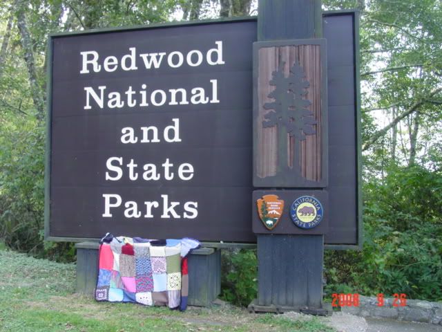
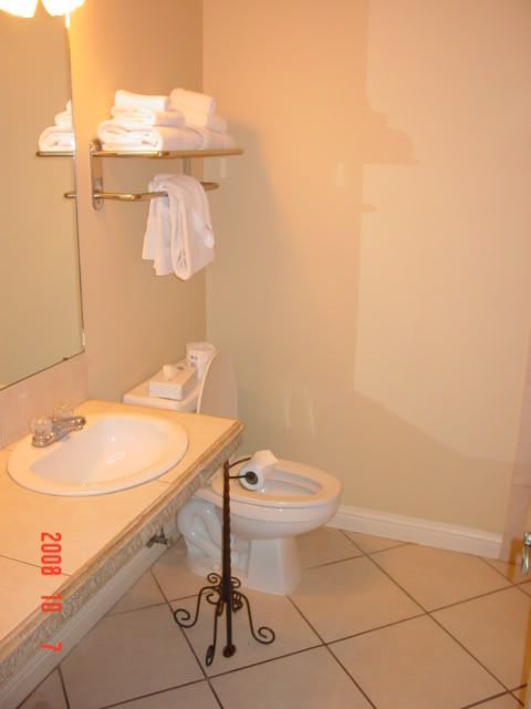
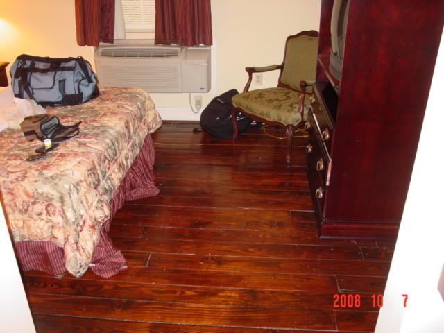
After crashing in a seedy hotel in Crescent City, CA for the night, I awoke around 8 and decided to photograph some big giant trees. Redwoods NP is in a few pieces, lining the far northern coast of California. It encompasses a large number of state and regional parks as well, but altogether its pretty much the same thing.

My handy National Geographic guide listed a few important turnoffs to visit and see big old trees, so I took off south. I decided to take scenic routes that are poorly marked and even more poorly paved. That my GPS lists the roads is a great help, as without it I wouldn't take such risky, unknown choices.


One thing that struck me immediately is that highway 101 is laid around the forest; the forest did not come to the road. Outside of a few trees in Oregon and some in north Michigan I've never seen any living object make a road move from it's intended path. The redwoods are large enough that their base is as wide as a 2-lane highway. The road is literally laid out to go around the trees. Hopefully that's enough emphasis on the scale of these monsters, because my pictures don't do them justice.


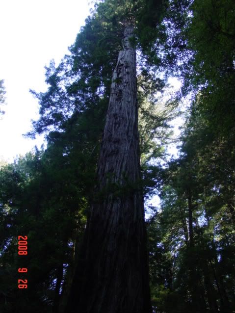
The next thing that struck me was the stillness, the overwhelming sense of insignificance that overwhelms you as you enter a redwood grove. Outside of a few far way bird calls there is no sound. None. The crunching of soft needles below my feet is deafening, even as my passage over them would be inconsequential under normal circumstances amid the hubbub of life. What's more there was a strong wind that day- blowing 20mph in from the Pacific. If I gave myself a neck ache examining the canopy I could see the fog and branches moving, but none of the normal sound associated with this phenomena reached my ear; it's so far up the sound doesn't carry. Furthermore that branches were probably swaying 20 feet or more, but at that scale appeared to not be moving much at all. Spooky.


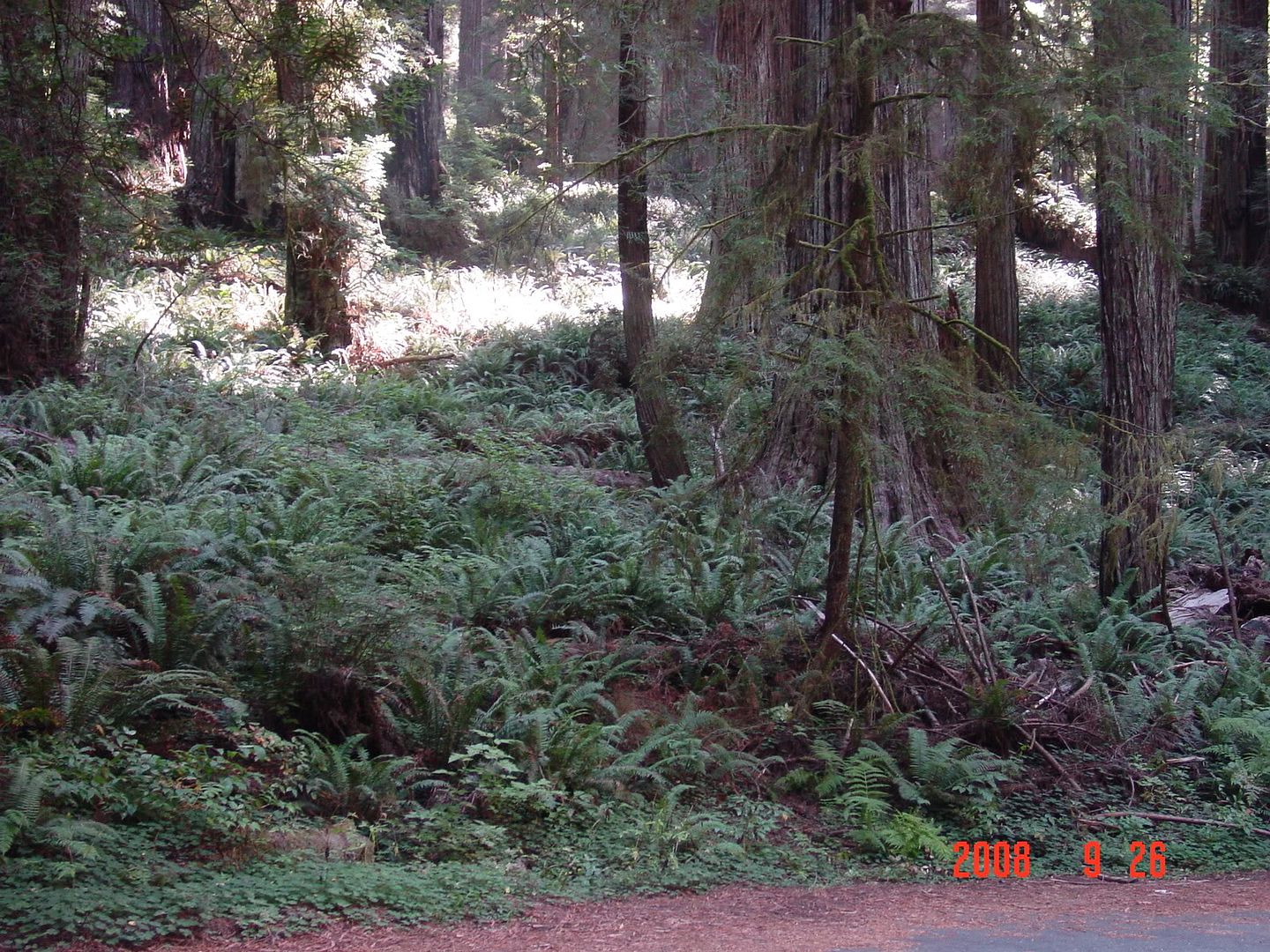
The ferns in the lower image are now my desktop background. This must be where people go when they are looking for inspiration about primeval conditions.
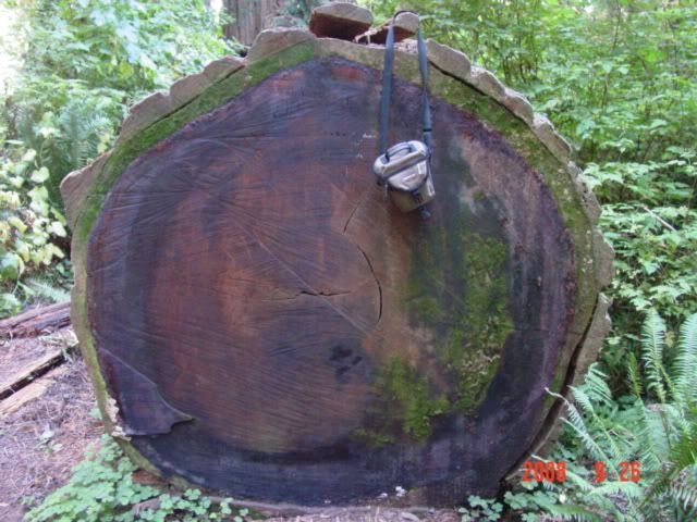
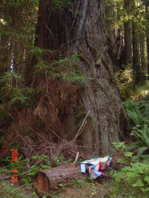

I found a log 
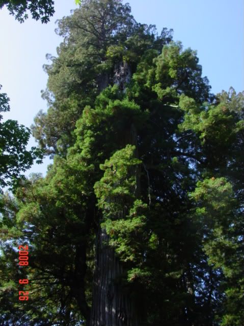
sawn in half, and I had no other method of gathering perspective on it, so my camera bag did the job. It's about 6x8 inches square. That's one old tree. The lower pic of the canopy and such is of a named tree-that I neglected to write down. d'oh. Anyways, if you look closely where the branches seem to separate into a foreground and background around the trunk you can see where the trunk is actually fallen off; the background growth is actually secondary, having occurred only after the main trunk broke off. What could make a trunk like that break? Don't wanna know. The record this specimen set is by the secondary growth trunk, I suspect the primary growth was even taller- and it still set a record.

There are more Very Big Trees in the Photobucket entries.

Otherwise I drove south for the rest of the day after leaving the park proper. I was interested that highway 101 still passes through numerous redwood groves in unprotected lands as I traveled farther south. In fact I saw them all the say south for the next 200 miles. Evidently redwoods used to range across the entire continental US and Europe during previous inter-glacial periods, but by the epoch humans had stepped out of their caves in, world climactic conditions only favor their growth (ie lots of water. lots) in this narrow stretch of California coastline. Sequioa and some other type of tree in China are the only remaining members of this branch of the plant kingdom. Some more info.

I ate lunch in a Subway in some hippie infested town along highway 101 called Ukiah. The subway itself was a gas station too, and they didn't seem to have a clue what they were doing in terms of selling subs. The sub itself was pretty bad too, the bread was stale. Otherwise there were anti-war protesters clogging the main thoroughfare with hand drawn cardboard signs and dreadlocks. Some people have no idea how to protest effectively. But, there's culture for you.

I had wisely made a reservation at a hotel in Novato CA, north of the Golden Gate bridge for the night. I wanted to get there to watch the first Obama-McCain debate of the election, which started at 6pm pdt, so I had to drive past all the wineries. Altogether not a bad idea though, as all the tours cost money and the wine is no better than you can find in a store. But, still, oh well.

Day 18, 9-27-08: San Francisco and ouch my arches!

Waking at 7, I read some more post-debate bloggering, before showering and heading for San Francisco.

As I approached the Golden Gate Bridge I thought first "wow, it really is big" and second "wish I could see more of it from the stupid fog". Knowing it has a toll, I kept preparing to slow down and pay the piper, but was pleasantly surprised when not only did there not appear to be a piper on the bridge but there were no signs indicating you needed to pay to cross the expanse. Could it be that something in this trip would cost less than I thought??!

Not so much. $6 toll paid on the south pier. Makes me wonder what they'd do if I said I had no money to pay the toll-would they send me back to the north side?

I had found a parking deck online the night before, and my GPS led me right to it. Sort of. GPS is nice for finding a street address, but finding the entrance to a 2-block parking deck? Nah. I spend 20 minutes narrowly avoiding going the wrong way on one-way streets before I found and maneuvered my way into the entrance chute. In retrospect parking in one of the tourist lots near the fish market would have made more sense and been cheaper than parking in midtown SF (5th and Mission). Alas, those decks are not online, and I didn't want to drive about the notoriously finicky SF byways aimlessly else I run over a bag lady. Live and learn I guess.

I got out and walked. And walked. Eventually arriving at the famous 'Welcome to San Francisco' sign above the ferry docks. They had an open air market going on this Sunday, and some of the people in attendance needed to stay in the open air else they fumigate the room. Otherwise lots of interesting Americana and hippiness.

I then walked north along the piers, towards the fish market and Alcatraz shuttles. I discovered that even though Alcatraz is some sort of a national landmark, the tours are run by private groups. Something about their marketing ploy turned me off, so I kept walking. Alcatraz is on an island right? So it's not like it can escape for next time I'm there.

I kept walking, west this time. My plan was to wander semi-aimlessly in the direction of the Golden Gate then turn south and meander towards Haight-Ashbury to see hippie central.


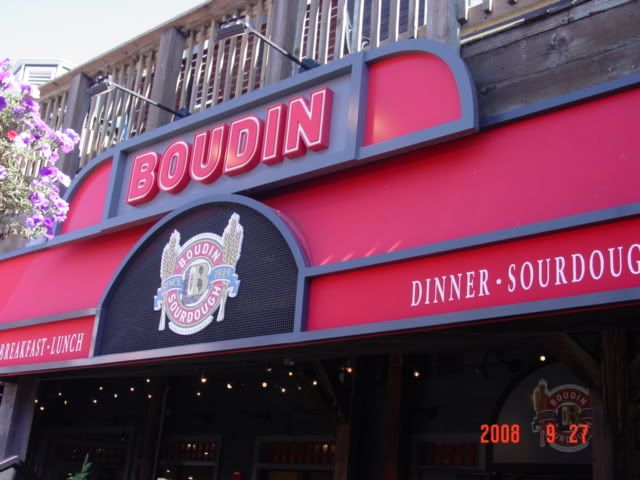
I stopped for lunch at a tourist-trap version of the famous Boudin's Sourdough bakery, on one of the tourist piers (31?). San Francisco sourdough is famous because you can only make it in SF; the particular sub-culture of S. cerevisae (S. Sanfranciscus iirc).


Linkies, ..., ...., Microbiology of it

In any case, the bread was amazing, as was the clam chowder and club sandwich that came with it. Truly a good use of the funds.

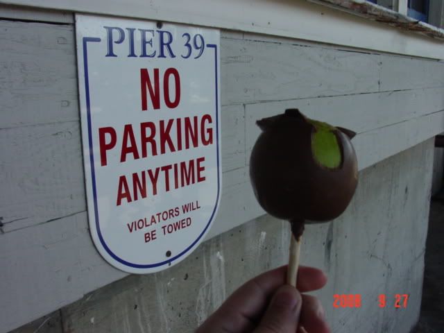
I then walked down the pier amongst the rest of the tourist rabble, and found myself in a chocolate shoppe, perhaps the same one Mom had alluded to before I left.
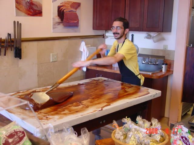


This guy was tempering the chocolate. Yum. I controlled the sweet tooth though- or rather the exorbitant prices did- and I settled for a semi-nutritious meal of apple and chocolate.
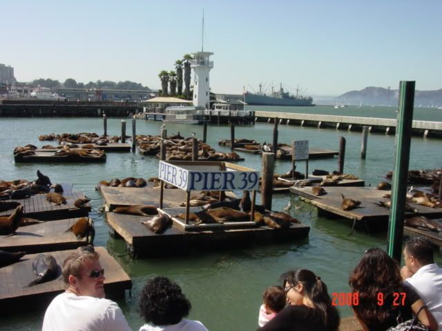


I then watched the 
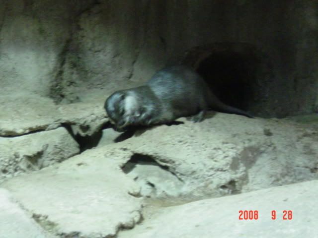
sealions carry on. The story is that after the 1989 earthquake the sealions began appearing on this pier for largely unknown reasons. Lack of food? Desire to belch at humans? Vanity? Anyways, it's become a tourist attraction, and after the Sea Lion Caves this is a better look at this family. And they still smell bad.


Anyways, I kept walking, eventually ending up near the Maritime historical park, which was free that day for some reason. I walked aboard the ships, and did that.

I walked to Fort Mason where they were having a Blues festival. Much 
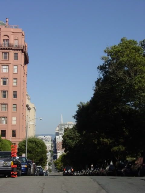
nekkidness and suspicious smoke was afoot. Anyhow, I turned south and began scaling one of the famous hills towards Lafayette Park. The view was okay, but cars kept trying to kill me as I took pictures.


Otherwise, mischief was afoot. Or rather, underfoot. My feet started aching about here. This in and of itself is not uncommon after walking city streets for 6 miles, but man would it begin to haunt me.


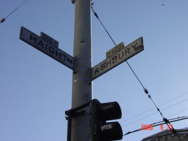
I made it to Hippie Central. Ironically, or not, there was a Ben and Jerry's on one of the corners. Much body hair and suspicious smoke hung around here too. I supported the area's habit by purchasing a Chocolate Fudge Brownie cone that promptly melted all over my hands. And I had no napkins handy. Now who's the hippie! gah.

Now to get back to the car. Not wanting to rely on anyone or anything I decided to walk it. Bad move. While SF is a nice city it is on the large side, and the 5 mile return trip from Haight/Ashbury to 5th and Mission was a painful one. My arches, see. Having graduated from simple aching to genuine pain with each step, I was soon limping more than some of the bums. That's hard to do, believe me.

Alas, I was unable to figure out the bus schedule, and I suspect that even if I had it wouldn't've mattered that late on a Sunday, as I saw no busses go by. SF is interesting in that the busses are often 'Zero-emission', being powered from suspended overhead lines. Setting aside the absurdity of the zero-emission claim no busses were traversing the power-line equipped streets. Ack!

Well, clearly I made it back, but was walking gingerly for the next few days. I stayed in a hotel outside Oakland for the night, ready for the trip to Monterrey the next day. I stayed so far from Monterrey as the lowest rate I could find near Monterrey was $100 a night.

Anyways, aching arches in tow, I settled down in a fairly nice place and called it a night.

Til later!


/off to Bourbon Street.