Monday, September 22, 2008

British Columbia is cheeky

I'm fairly certain I'm misusing the term cheeky. Which in and of itself is cheeky. Cheeky Brits.

Anyways, Vancouver and Victoria are interesting cities and worthy of blogging and travel. Although I recommend not taking your car with you to Vancouver Island- it's not really needed and costs alot.

Day 11, 9-20-08:

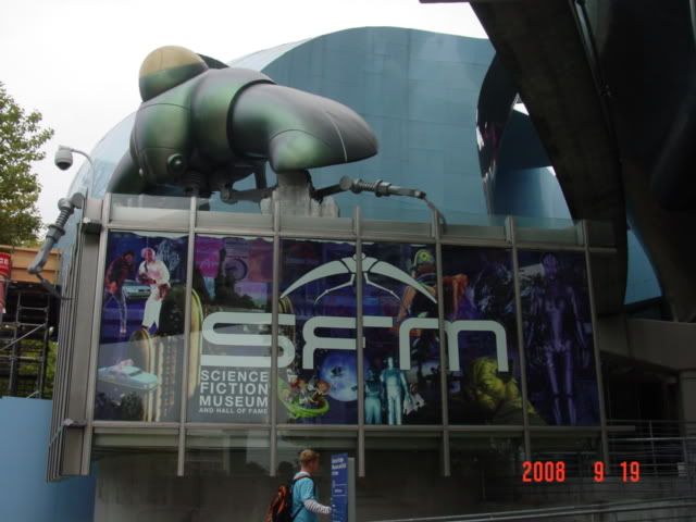
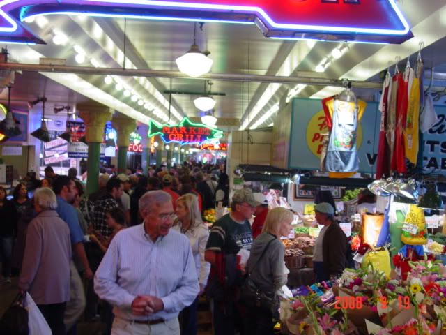
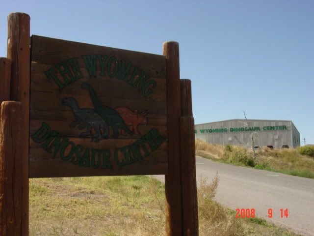
Having visited the streets and subterranean passages of Seattle I struck north from my room near the straits of Juan de Fuca (here on Google Earth) for Vancouver, British Columbia, passport in hand. After 90 minutes of drizzle and stop and go traffic I arrived at the checkpoint. As if on schedule I began stuttering to the border guard, who then suspected me of being nervous. Always a fun thing to encounter, even if it is only Canada. Anyways, after sorting out our language barrier I made North again for the first visitor information kiosk sign I saw. Low and behold the Canadians are as bad at marking things (while it's still raining, harder now) as New Jersey is, and I passed it three times before finally finding the center. The fact that the building is a fairly nondescript house didn't help my directional senses much. And the fact that the center is closed on the weekends didn't help either. You'd think that if you had a close a visitor's center for 2 days a week you'd pick weekdays, like Tuesday and Wednesday, not Saturday and Sunday when all the bloody tourists visit! Blast!

After grumbling a bit in my own special way I made my way north along the Canadian version of an interstate in the direction Lucy stated. Who's Lucy? My 3 x 4 inch black box with an LCD screen, woman's voice and demanding "Recalculating" manner. Like Wilson, but less bloody. Anyways, before long the interstate devolved into a surface street-20 miles outside of Vancouver proper. Don't these Canadians know anything? It's like they're driving on the worng side of the bloody road! I spent the rest of the morning crawling towards downtown Vancouver amidst the sodden groundlings, who, incidentally, all had really nice cars. And not jsut nice compared to my one-eyed hailed-damaged menace but compared to American cars in general. Houses and streets too. Clearly, there's a conspiracy about, and this is what happens when you don't spend 25.5% of your national budget either defending yourself or paying off your credit card. Cheeky, if you ask me.

Anyways, downtown Vancouver was still raining, so after seeing a few buildings from my car window I said 'meh' and headed for the ferry to Vancouver Island. I hadn't been on a ferry or indeed any large boat in awhile, and I wanted to make sure they still worked. And I'm on Holiday, after all.

Well, much to my chagrin the ticket lady asked for 66 Canadian dollars. I tried to give her Fritos but evidently the Canadians do in fact have real money and are not living in a Socialist Paradise like Bill O'Reilly keeps telling me. My childhood is ruined, but thankfully Visa saved the day.

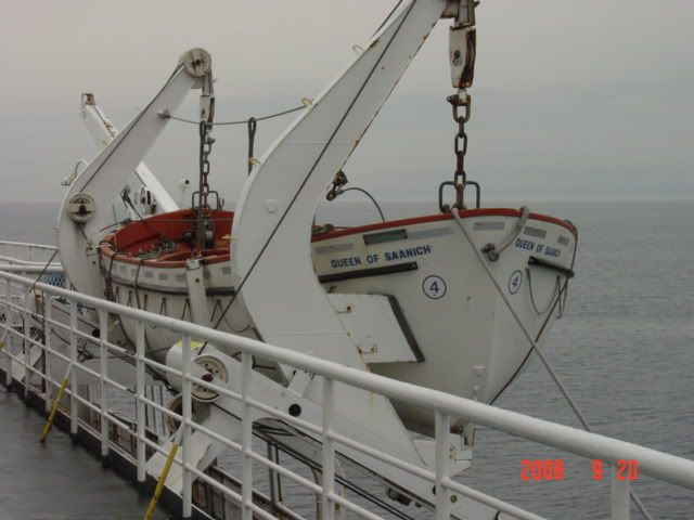
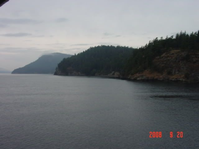
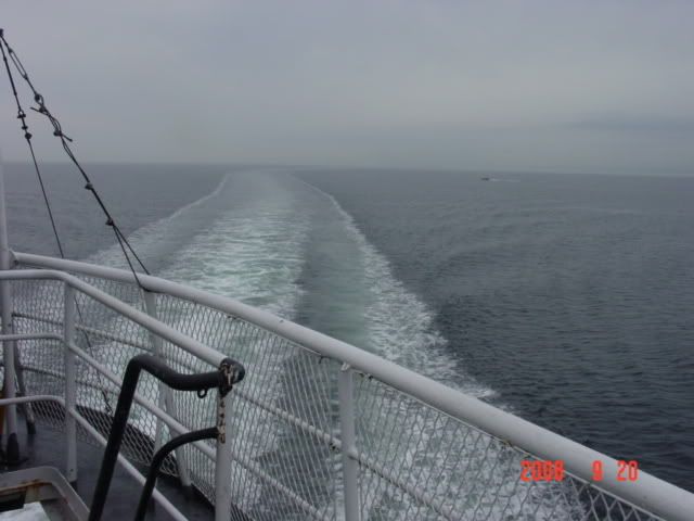
The ferry was a big giant boat, and did not grant me three wishes no matter how many times I asked. They sure spell ferries funny in Canada though. We left Vancouver harbour around 2pm and arrived at the Swartz Bay terminus around 4:30. Jolly good.


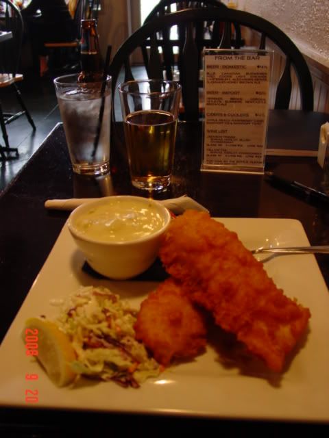
After daring fate by nearly rearending a Passat on the slippery highway from Swartz Bay to Victoria, I settled for a campground midway between the two ends of Saanich peninsula near Sidney, BC. I decided that since it was too cold to type that a trip to Sidney for dinner was in order. I asked the campground lady for good fish places and was sent to the Salty Dog in downtown Sidney for a meal of Fish and Chips. When in England... and all.


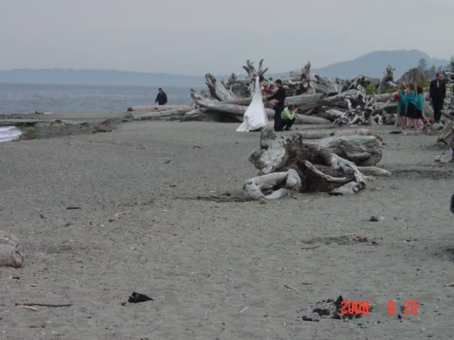
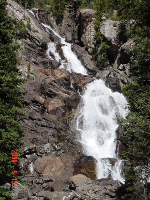
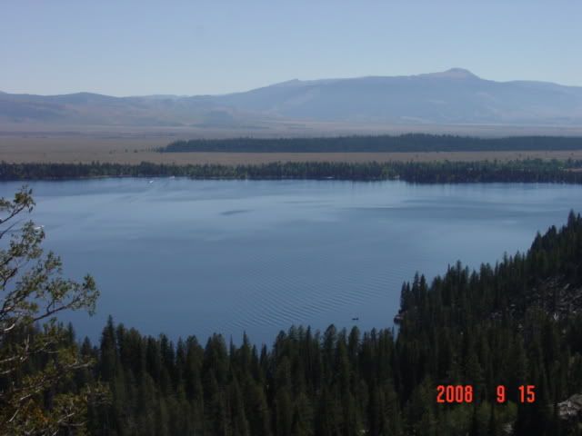
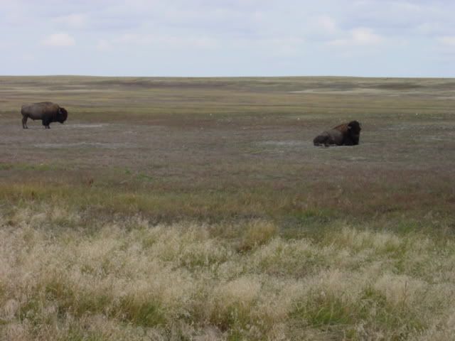
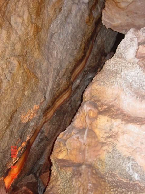
I then took pictures of the surrounding islands and the cloud blanketed slopes, both across from Sidney and from the campground. But they're pretty boring, so here's a pic of driftwood. Exciting!


I fell asleep around 9, while entering the mysteries of why Australia is the biggest ecological CF on the planet in Jared Diamond's Collapse. And some crazy mosquito hawks kept dive bombing me with the flasahlight on in my tent. Scary little buggers.

Day 12, 9-21-08:

I awoke early and encountered my first pay showers of the trip. I decided that I wanted two Loonies worth of hot water (14 minutes). Plus it's a nice way to warm up before freezing again while drying off. I said toodle-oo to the campground and headed for Victoria.

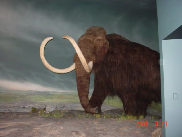
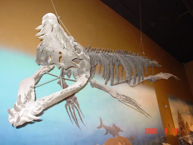
Victoria is the capitol of British Columbia. Which means it has a parliament, but alas, none of those guards in the absurd buffalo hats and redcoats. I found a place to stay for the night, along with a parking space for the whole day, and proceeded to get my Holiday on. My first and main destination for the day is the Royal British Columbia Museum. They had a nice brochure I found outside the closed visitor's center yesterday, along with an IMAX theater. 23 fake-looking Canadian denominations got me inside and an IMAX pass for a show on dinosaurs. Brilliant!

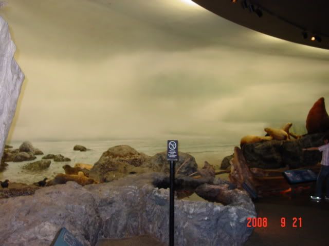
All kidding aside, the RBCM is one of the most impressive museums I've ever seen. All the displays are intricately done and in exquisite detail. The mammoth is very lifelike, and the totem pole displays are ornate and tasteful. Truly, an impressive museum and well worth Canadian excursion.


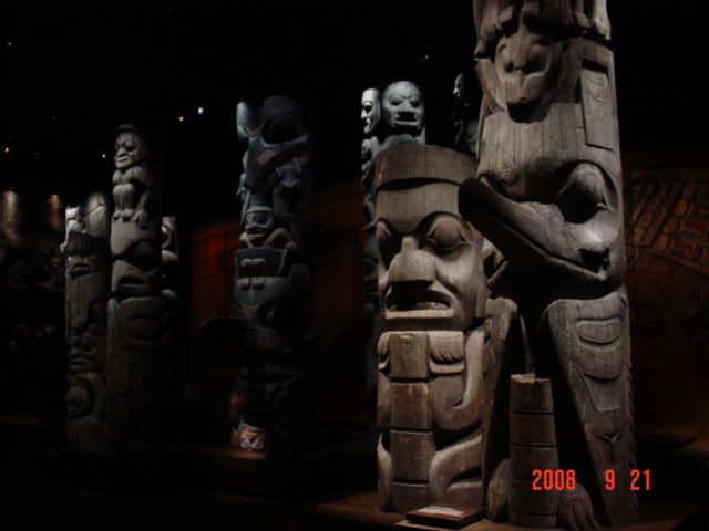
The Indian/Native American/First People exhibits took up much of the exhibit halls space, and the place seemed a little on the small side, but I enjoyed it all and learned much about the area's history and culture. Wicked.

Next I ventured about Victoria, keen as mustard looking for things to do. Alas, there wasn't much else available that was either cheap or open on Suunday. So I kept walking, ending up down at the docks, around the Victoria to Port Angeles ferry terminal I'd be taking tomorrow and generally getting a good look around the allys and streets of Victoria.

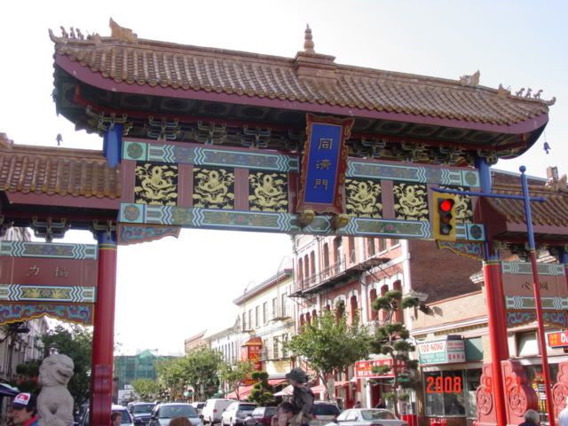
Other than Chinatown, there seems little fun to do in Victoria outside the museum. Maybe I missed it?

Oh well. I found a place called the Olde English Pub and had some more fish and chips before retiring to my room around 8pm. I then proceeded to blog from last night and stay up watching True Blood and Dexter episodes on premium channels. Altogether a fun day, while the RBCM is really something.

I plan to be in Bend, Oregon on Wednesday the 24th, at the invitation of Mrs. Renee Martin, mother of Karee Martin lately of State College PA. I hope to blog again then. Until then, have fun and don't get your knickers in a bunch!

Sunday, September 21, 2008

It's wet in the Pacific Northwest

Shocking news from a trusted source in snark: it rains alot west of the cascades. I didn't see the sun for 3 whole days after I saw the clouds streaming around the peaks as I finished the last leg of my trip to Seattle down I-90. And then it rained. And rained. Yesterday I started thinking that the US could increase its arable land by a few million acres if we just knocked down the Cascades to let all that wet move farther east. Then I left rolled up my sodden tent and got something warm to eat. Anyways.

Day 9, 9/18/08:
Seattle or bust

Leaving my 2-day hotel room in Missoula I charted a course to Seattle, Washington. As seattle is home to Seahawks, Space Needles and Nirvana, I decided that this should be heaven. Go ahead and groan, now. Then my GPS toy showed me a 450 mile journey ahead of me. After a sigh, I hit the gas and rapidly traversed the remains of Montana and the sliver of Idaho (no, Udah... nevermind). I didn't realize Spokane was so close to the Oregon/Idaho border, and having decided that I wanted pizza for lunch, found a mall in Spokane with a suitable Sbarros and ate an overpriced meal in the peace and comfort of screaming ankle-biters.

On the issue of overpriced, I've decided that I'm running out of money faster than anticipated. Instead of taking to responsible approach of not eating at Sbarro's anymore, I concluded that I am going to shorten my planned trip by a few weeks. This basically means I won't be driving through southern California anymore (or at least not stopping). Given the expense of the cities I've seen so far I imagine that CALEEFORNYA will be much worse. Thus, I am going to do some more stuff around the pacific coast (Karee's mom's place in Bend, Crater Lake, Redwoods and San Francisco) before traveling directly for Hoover Dam/Las Vegas, then on to New Orleans before turning back north for Minnesota. I know this will be a let down for some of the Blanketeers now residing in SoCal, but them's the breaks. 'Sides, Florly at least still needs to graduate, and I assume that she'll be doing so in person this fall. I am planning tentatively on attending falls PSU graduation, so unless the stars align and I have a job thing before then I'll see her and Matt then.

Moving on, I crossed the rest of the semiaridness of eastern Washington without a hitch, stopping only for gas and to take pics of the Columbia river crossing of I-90. Evidently there are forest fires about that are obscuring the landscape more than the resident smog. Maybe; not like I could tell a difference anyhow.


I tried unsuccessfully for 2 hours to find an open campground to no avail. I finally settled on a hotel in Everett, Washington in a seedy part of town.

Day 10, 9/19/08:
Seattle proper

Today I awoke to the sound of street racers revving their engines for some sort of non-existent race. Charming. I drove to Seattle. I considered stopping at a car pool place and taking a bus in but decided that since I didn't know the city nor where I would be staying that night, I was better off finding a parking place downtown.

I ended up parking near the Seattle Center, which I surmise is the location of the Seattle World's Fair for which the Space Needle was built. The site also has a number of museums and amusements. Given that it was a cloudy day and it would cost $15 I decided to forgo the trip to the top. I instead opted to visit the SciFi musem in the Seattle Center area. The Experience Music thing was included in the price of admission. I saw some cool scifi kitsch inside, but was underwhelmed by it all; too many blasters, not enough history or depth on well-known or otherwise scifi franchises.


I then trekked across Seattle, by foot, to the central market area. This cacophony of sound, sight and smell was truly a wonder all on its own. The market area covers a hill that leads from the docks at sea level and the upper city, about 40 feet above the docks level. This means that the main buildings in the market area look deceptively small, belying the 6 or 7 stories of small shops that inhabit the market. This means there is a huge concentration of open market commerce in the heart of Seattle that would not be obvious if you didn't explore it. I found shops selling everything from oriental herbal supplements to fish to chocolate to fish to fish. Did I mention the fish? Smell and sight? Yeah, they sell alot of fish there.


Next I hoofed it to the underground tours. This business revolves around skimming money off tourists for a 90 minute look around the underground of Seattle. Admittedly, the history is interesting, as are the tour guides themselves (my kind of satire) but the understories themselves were a bit disappointing. Anyhow, Seattle was built on a floodplain. There was nowhere else to start a fledgling city back in the 1850s, as the shoreline for miles in both directions was steep and rocky. Remember above where I mentioned the hill around the market? That's part of this. The city had a flooding problem, what with the strong tides related to the city's latitude. Furthermore they had a problem with sewage backwash when the tide came in. I imagine the sewage problem gave the fish smell a run for its money, but in any case none of that mattered after the city burned to the ground in the 1890s.

Upon the charcoal that was once Seattle the townsfolk decided that they still wanted a city here. But in their wisdom and olfactory satisfaction they decided to raise the level of the city streets above the high tide mark thus removing the backwash problem. In order to do so the guide said they had to move more dirt around than was moved building the Panama Canal. But without the Yellow Fever, and not to mention without invading a sovereign nation. Unless of course you count the Indians/Native Americans/First Peoples. Anyhow, the merchants didn't want to wait to put up buildings and start making money again until after the streets were raised, so they built their businesses at the old, lower, level with the intention of eventually doing business from the second or third story of the buildings after the streets, sewer pipes and City was raised and regraded. Hence the birth of the underground city tours in the 1960s.


And with that tour done and more shot glasses purchased I headed back to my car to look for a place to sleep before my trip to Vancouver on day 12. I decided to try to stay at Deception Point State Park, but after arriving to find a $25 camping fee and $15 State Park entrance fee, I said to hell with it and stayed in a hotel. Unfortunately it lacked a wireless connection, but alas, there we are.

Tomorrow or the next day I'll chronicle the Great Canada Trip. Until then, thanks for reading!

Friday, September 19, 2008

Glacier National Park

Hello

Here's where I've been for the past two days. Hard to believe it's already day 9 of this trip!

Day 7, 9/16/08:
Computer Day

I awoke around 8 with the intention of finding a laptop in Bozeman, MT. Alas, Bozeman has pretty slim pickings in regard to computer stores, but I was helped by a gentleman named Clint Heath who overheard my question about computer stores I made to the desk clerk. He told me of a Best Buy in Missoula, MT, and a good inexpensive place to stay in Missoula. After conversing for a few minutes I packed up my stuff and made for Missoula, about 140 miles from Bozeman along I-90. But first I got an oil change in Bozeman.

In Missoula I got a room for 2 nights at the place he suggested: the Creekside Inn. I then went and found the Best Buy and after figuring out which laptop was the shiniest I settled on the Dell Inspiron I linked a few posts ago. So far so good. I also bought a tube of super glue to reattach my GPS mounting plate to my dashboard, as the hot-glued one had fallen off. I suspect that removing the plate will now take part of the dashboard with it, but it certainly won't be falling off anytime soon.

I then spent the rest of the day tooling about Missoula, then retired to my room to set up my laptop, make blog posts and prepare for Wednesday's activities.

Day 8, 9/17/08:
I decided to make a day trip to Glacier National Park, returning to Missoula that same day. Given my experiences finding a good place to stay near a national park vis a vis Yellowstone, along with the fact that Missoula is ont the way to Seattle (via I-90) this seemed a prudent course of action.

Leaving at 7:30am, I needed 10 hours to complete the 500 mile round trip. I planned to drive to Glzcier NP via Flathead Lake and travel east across the 'Going to the Sun' hwy that bisects the park north and south. Alas, even in mid-september the road was already closed. To snow? nah, that's too easy: the road was closed on the west end due to road construction! crap. So, I changed plans and drove east around the southern end of the park on the same road I planned to drive back on from the west. But I still got some cool pics.


More are located in the Photobucket site linked to the right.

The glaciers are relatively small, in my opinion. Granted it's september and they should be near their smallest before it gets cold again, but still. Matt Licata, a friend from Dr. Glick's lab who visited Glacier last year told me that the glaciers were projected to disappear entirely in the next few decades. See em while you can!

I also found a few humour pics. The first being the blatant and effective tourist trap of a giant purple wooden spoon. Very well done. The second being a few cows napping lazily along the road I was taking. They required photography.


Since I was already on the eastern side of the park and didn't want to backtrack, I decided to take a longer but new and more scenic route back to Missoula. I traveled south along the glacier range almost to Helena before turning west. I saw alot of semi-arid ranchlands along with cows, more road construction and beautiful terrain.

I arrived back in Missoula, and prepared to cross the rest of the Rockies then Cascades and find someplace to stay in Seattle for a few days. More on that in the next update.

Thanks!

Wednesday, September 17, 2008

Grand Tetons and Yellowstone National Parks

Another update, another couple of days while I try to get back to regular posting after the laptop debacle.

Day 5, 9/14/08:

After waking up in Buffalo Wyoming I drove through the Bighorn National Forest on my way to Grand Teton National Park. Bighorn is high up, about 8k feet, and includes a stretch of road called the Cloud Peak Skyway. As you can imagine there are alot of high peaks along this road.


I saw my first real mountains of the trip here from the firsthand perspective. Also saw some glaciers on top of the peaks, which are included in archive pics that you can access from the link to the right.

I endeavored to stop at a site called the Medicine Lodge State Archeological Site, which, according to my guidebook was a working dig site that included paintings and much artifacts. Alas, I gave up on finding the site after 2 hours of searching the backroads of Wyoming for the correct needle in the haystack of unmarked logging and cattle roads. Even my GPS thing was confuzzled, always telling me to recalculate and turn around. I had some fun pseudo-offroading though. Besides, the book says I had to pay to enter (boo) and it was a Sunday and may not be open anyhow. meh


Quite by accident I stumbled on a place called Thermopolis, Wyoming which boasts both the largest natural hot springs in the world and a dinosaur museum. Cool. I tooled about the springs for awhile, finding myself at the orgin of one particular vent and the anticipated scent of rotting eggs-sulphur (or sulfur). Lots of multi-colored algae too.


The Wyoming Dinosaur Center is a privately funded dig site operation that is actually quite well done. Much of the place is a tour of the planet's geological and paleontological history from 5 bya to the present. I actually learned something that on its face should have been obvious: all dinosaur species were only around for 5-10 million years during the 300 million years or so years of the dinosaurs, so most drawings that show different species together are false on that account. The notable exception is the classic T. Rex vs Triceratops. They did in fact co-habitate in time and space, so childhood reminisces of Dinobots in battle are not broken altogether.


Next I drove through the desolation of central Wyoming on my way to Teton. This area is devoid of much vegetation save sagebrush and cows. Yay water!

The Grand Tetons National Park is smaller than Yellowstone but encompasses the imposing Tetons range. What makes this range particularly unique is their situation on a fault line that causes the Tetons themselves to continue jutting skyward with te eons while the land next to it that is covered by Jenny Lake and nearby environs is subsuming at a similar rate. One side is rising, the other is falling, creating the unique lake/mountain boundary that is so dramatic. The landmark in the top picture below illustrates this concept.

Anyways, the mountains are amazing. I stayed at a campsite the first night, near Signal Mountain lake. The campsite is nice, if crowded by other campers. I met a couple there named Jesse and Samantha. They were on a weeklong vacation and proceeding to Yellowstone and back to their home in Seattle. They shared s'mores and conversation for the night. The night which when I awoke had dipped to 35°F. Brr. But being the dry west it was 80°F and sunny by 2pm.

Day 6, 9/15/08:

I decided to hike around a Jenny Lake. Jenny Lake is a few miles north of the main part of the Tetons range which I show above. After a brisk 3 mile hike to the other side I started going up and found a place called Hidden Falls. As I'm sure you can image the falls are hidden in a ravine, and give some cool pics below. From there I climbed about 700 feet in half a mile of switchbacks to Inspiration Point. Real ingenuity and creativity in the namings; I suspect that the guy who named them is also responsible for such doldrums as North and South Dakota. The top pic is of course Hidden Falls while the bottom is facing East overlooking Jenny Lake from Inspiration point.


I saw two interesting animals up close on the hike. The first was a beaver, which I conclude it must be from the way it was wagging its wide tail and lines around its eyes. I saw it/him/her from about 10 feet as it drank from a spring along the side of the trail. Alas, the beaver did to cooperate in out staring contest for long enough to get my camera out, so I present to you a picture of the leaves it disappeared into, along with a image I ripped from the 'net of the markings I saw that told me it was a beaver (along with the tail).


On the way down I spied a peculiar critter in a rock, hunting for...something. I suspect it is a pika. Alas, the little ball of frenetic energy did not cooperate long enough for my camera to focus, so I present to you a Fuzzy Pika.


After the hike I tooled around the park, encountering numerous "Bear Traps" of stopped cars and gawking seniors watching mule deer eat or elk off in the far distance. I'm glad mom lent me her binoculars but unless you have one of the massive telephoto lenses some people cart around like bazookas I can't support looking at critters more than about 200 yards off, as there's no detail to be had.

Ate lunch of mom's strawberry jam with crunchy Jif on wheat hamburger buns, gassed up at the especially outrageous gouge of $4.15/gallon and proceeded across the Rockefeller Jr roadway to Yellowstone National Park. Along the way I encountered my first of what I doubt will be my last instances of road closures in the sparsely populated west. Because there are no side-streets to reroute traffic onto when a road is closed for repairs, they simply close the whole thing. Then they have these trucks called "Follow Me" trucks that go to one side of the closure and guide that direction's traffic across the unpaved and working construction vehicle infested roadbed. Once you're across the Follow Me truck turns around and guides the traffic on that side back across the Neutral Zone. Romulans are sure to attack at any time. But the worst part is that you can be sitting on your side for easily 30 minutes. The some shmuck in front of you falls asleep as you're getting the go ahead sign. geeze. I almost prefer the backups along I-80 outside State College to this.

But, I finally got to Yellowstone. 45 minutes after I wanted to.


Well, let me just say it. Yellowstone sucks.

  • It is crowded, even on a weekday in September. Bear Jams everywhere.
  • It is full of impatient a--holes who want to go 65 in the 35 zones. And there's seldom a place to let them by.
  • Three-quarters of the campsites are closed for the season. In mid-September.
  • The remaining sites are already full.
  • The most basic cabin costs $90 a night and has no shower.
  • The nearest town is 45 minutes on beartrap infested roads from anything cool in the park, and rooms start at $100 a night for the dumpiest dump that ever dumped.

So, when faced with an overcrowded, backed up, overpriced and unfun national park I decided to bag it. I instead drove til 11 pm on to Bozeman Montana where I wanted to try to find a new laptop. I stayed at The Rainbow Inn in downtown Bozeman for $50 a night. Yellowstone? meh

That's it for now. til tomorrow!

Tuesday, September 16, 2008

Day 7: from Missoula, Montana

Greetings Blog readers and web surfers

Total Miles Traveled: 1981.
Times fueled: 7
Avg fuel economy: ~36 mpg
Avg price of gas: $3.85
Times I've cursed various oil-invested groups and persons: yes
Times I've used my National Parks Pass: about 6
Current Altitude (9/15): 3,209 ft.

With my computer problems squared away I can return to the subtle and satirical art of blogging. The past 5 days of travel seems to have flown by as fast as my car down the 75 mile per hour interstates (and 70 mph 2 lane roads) in South Dakota and points west. I wake up at 7 each morning and am on the road by 8:30, but before I know it it's 6pm and I'm looking for a place to sleep.

It's cold at night. No shit right? Normally I would not care, as cold weather camping is not an issue with me. It's the cold weather blogging and journaling that is complicated. Thus, I've only spent 3 of the first 7 nights of this trip in a tent, the rest in a (usually smelly) hotel room. Granted, I'm burning through cash faster than Halliburton, but it's worth it to keep cold at bay and ink flowing. I plan to camp out much more as I approach the southern portion of my trip.

On to the daily adventure recounting and Where's Waldo action:

Day 3, 9/12/08:
Today's objective was the Badlands and travel into the Black Hills. I started out visiting the National Grasslands Information Center in Wall, about 3 blocks from my campsite of the previous night. Cool video and info. Really makes you appreciate the shear number of federal agencies involved in land stewardship-and whether they could be organized better.


Next I headed to the Badlands National Park. The park encompasses an area that geological uplift in the Black Hills has coupled with erosion and settling elsewhere to expose a large area of sedimentary deposits to the ravages of undercutting by the White River. This has resulted in the unique and beautiful patterns of soft porous rock being stripped away rapidly (on a geological scale), creating this long line of cliffs over just the past 500,000 years. Anways, it looks cool and has a unique place in the park system. It also has prairie dogs and bison. An outrageously expensive shot glass acquired too.


Next I decided to go off the beaten path, driving SW out of the park instead of back up to I-90 on my way to Rapid City, SD, gateway to the Black Hills. It was fun, if dusty, exposing the vast emptiness that is much of the American Plains. It's a nice place to visit and meditate, but live? Not so much.

The Black Hills are another unique geological region resulting from volcanic uplift that thrust the basalt, granite and feldspar hard rocks up from the lower crust layers, exposing them and creating the Black Hills region. The Black Hills are also geologically unique from the Rocky Mountains (and formed by different processes); there relative proximity is coincidence. Anyways, they are cool, forming caves and rock faces for humans to spelunk and carve.

Mt. Rushmore is the most famous attraction in the Black Hills, spawning the rest of the region's growth into a regional vacation destination and Cash Cow for South Dakota. I'm told North Dakota in jealous. The five heads of Mt. Rushmore symbolize all the greatness in America, especially the two with glasses. Shot glass acquired too.

I spent the night in Custer, SD, a town with more hotels than bars and churches put together. It's also close to both Jewel Cave and Crazy Horse, sites on tomorrow's visits.

Day 4, 9/13/08:
Today's agenda includes Jewel Cave, Crazy Horse, Deadwood and Devil's Tower.

In addition to driving rocks upward the events that caused the Black Hills hill and mountai formation created many cave systems that stretch for miles below the region. Jewel Cave and Wind Cave are National Monuments and the largest cave systems in the area, while numerous tourist traps invite you to see other smaller cave systems. Jewel Cave has, I think, 140 miles of mapped area, with an estimated 7 billion cubic foot volume-the 140 miles comprises 2-10% of that volume. Wind Cave is similar but farther south and I didn't want to drive there.

I saw lots of spooky stillness, and was happy that I left my flashlight in my pants from the previous night so I could use it to see into the crevices not illuminated by the trip's floodlights. The most interesting formation to me was the only one that involved cooking, and fortuitously the cooking involved bacon. The formation below is called a bacon ribbon, and is the longest known. I don't recall what the guide said about it otherwise as I was thinking too much about breakfast. $8 to see the caverns, and well worth the 2.5 hour time investment. No shot glasses available, prolly due to the no food/drink/fire theme of the cave.


Next is the Crazy Horse Memorial. A bit of a twist on the age-old trait of the White Men building everything bigger and better, Crazy Horse dwarfs Mt. Rushmore. Mt Rushmore is about 90 feet tall (neck to top of head) while Crazy Horse is (or will be, someday, hopefully before I die) 653 feet from horse hooves to the feather in Crazy Horse's hair. It's big. I could see it clearly from 8 miles away. As such it's hard to get a good perpsective on the size given my limited photographic assets, but note that Mt. Rushmore would fit in the area that will become Crazy Horse's hair (right of the finished face). It's that big.

The accompanying museum and tourist trap was less impressive to my eye, as the displays were poorly organized and amateur in their attention to documentation and detail. But there was alot of it, from Kachinas to headdresses. Worth a trip, if only to see how many more thousands of tons of granite have been blown away in subsequent years. Also they do a laser show at night that illuminates the final form- I missed this due to rain the previous night. Shot glass and postcards acquired, along with the beginnings of a farmer's tan.


Deadwood was an overpriced casino. And not even a very cool one. Not worth stopping, even for the (fee-requiring) cowboy and robber kitsch museums. Bought (overpriced) gas and moved on.

Devil's Tower is amazing. Truly, a natural wonder, landmark and all-around bada-- piece of basalt. The standard theory of it's origin is as a plug of lava that formed at the bottom of a volcano's caldera. Heat and pressure turned it to very hard basalt that resists erosion so well that even though the plug formed a mile below the surface, the rest of the land has eroded down to the level of the plug and then 700 feet farther down. The unique hexagonal pattern comes from the way it cooled and cracked, similar I'm told to how cracked surfaces form on a mud puddle. /shrug ok.

Crazy People were climbing it, and a climber dude told me it takes 3 hours for a skilled Crazy Person to ascend and an hour to rappel back down. Notice their size relative to the rock face in the pic below. Well worth the stop.


Wyoming is big. Or as a guy told me at the next gas station, "F---ing huge". So I decided to get a head start on the slog to Grand Teton that day. I drove until 7pm all the way to Buffalo, WY from Devil's Tower (which itself is NW of the Black Hills 30 miles, and on the foothills of the Rockies, sorta near Sundance, WY).

My fingers hurt, I'll update for days 5,6,7,8 tomorrow. Plus this is already getting to be a long post. If you have any questions or comments feel free to ask in the comments section below; I'll provide whatever answer I can in a customarily snarky and hopefully funny way. Also, feel free to email me Q's if you don't want to create an account, needed to leave a comment. Although blogspot is run by Google, so you can use that password and login to create a Gmail account as well. Fhorvath@gmail.com

Also, I updated the travel map, and am adding a link to the image dump region I'm putting all my pics on and hotlinking from. Feel free to visit for some other more in depth images-often they have descriptions.

Adieu!